|
Finally leaving
the construction area, we were able to get back up to highway speed and
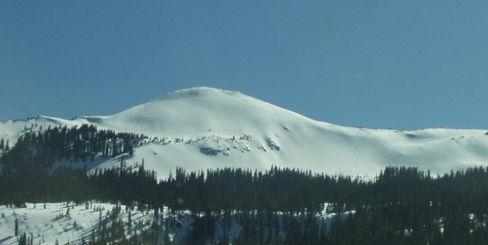
proceeded to climb up Wolf Creek Pass. As we neared the summit, we saw
the surrounding nearby mountains with lots of snow on them.
It was our intention to stop at the top of Wolf Creek Pass and get a picture of the summit sign. When we arrived there,
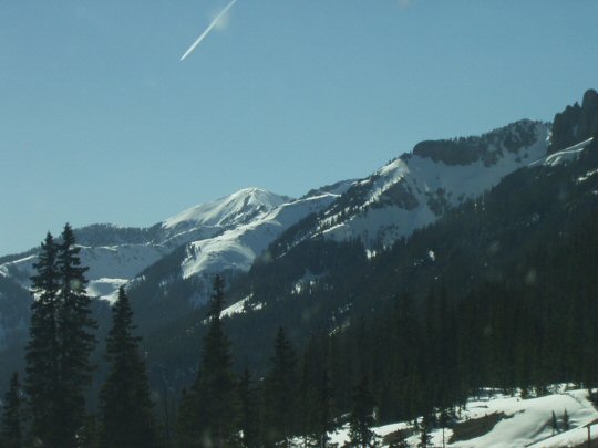
we got a disappointing surprise. Due to lots of blowing snow during the winter, and snow plows to keep the pass open, the sign was almost completely covered by a huge snowdrift. So much for that idea. (How dare them! You would think they'd have the courtesy to uncover the sign for all to see!) As we headed down the other side of Wolf Creek Pass we were treated to more sights of snowy mountains.
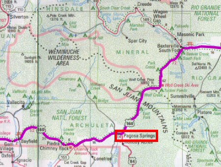
The road leveled out when we reached the bottom, and we continued on for some distance to Pagosa Springs.
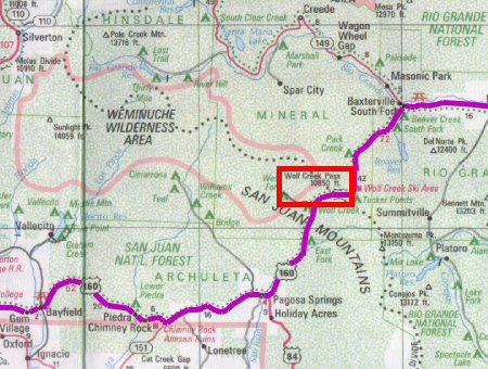
We are reminded of the song "Wolf Creek Pass" by C.W. McCall. In the song, he says, "Well, from there on down, it's just not real pretty. It was Hairpin County and Switchback City. One of them looked like a can full of worms. Another one looked like malaria germs. And right in the middle of the whole dang show, is a real nice tunnel, now wouldn't you know. ... Went down and around and around and down. We run out of ground at the edge of town. Bashed on into the side of the feed store in downtown Pagosa Springs." >Well, we didn't go through any tunnels, unless a snow shed counts. We did see a tunnel, though. Part way down, we passed another area where they were doing some construction. It looked like they were building a tunnel through a small section of mountain. Maybe they are going to increase the width of the highway, and put in a passing lane on the eastbound side. We also saw plenty of Runaway Truck Ramps going down. So I guess "Went down and around and around and down" is not really a possibility since one can use any of the conveniently placed truck ramps to stop. A runaway truck ramp is a very long gravel "road" going uphill off the main highway. The gravel combined with the uphill climb and the length of the ramp help to slow down and stop a fast moving runaway truck. Looking at the map above, it appears to be some 20 miles from the bottom of the pass to Pagosa Springs. Considering that the road is fairly level along this stretch, a fast moving vehicle would eventually slow down long before it ever reached Pagosa Springs. Not only that, when we reached Pagosa Springs, we didn't see a feed store. There is probably one there, but we didn't see it. We also don't know where "downtown Pagosa Springs" is. A runaway vehicle is going to crash into something else before it gets to downtown Pagosa Springs. Ah, well. A
musician's liberty, I suppose. Probably something like poetic license,
but for music.
|